The Best Wine
Needs the Best Site
Assessment Tool
Vineyard Site Assessment
and Management
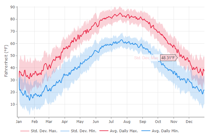
The perfect glass of wine is dependent on how well your grapes thrive during the growing season. This simple tool will help you evaluate your vineyard by taking detailed soil and climate data; along with slope, aspect, and elevation maps to evaluate the suitability for your site.
Our Site Evaluation Report summarizes various soil, climate, and topography information to assess your Vineyard site in just a click.
GeoVine™ is maintained by Virginia Tech’s Center for Geospatial Information Technology and is currently available for the state of Ohio. If you would like to add your region or state please contact us at cgitsupport@vt.edu
If you need help, or to learn more about how to use all of our services, visit the GeoVine™ Tutorials.